About Topo Maps US
Download and view topographic maps covering the United States. Topographic maps are useful for recreational activities such as hiking, canoeing, camping, fishing, mountain biking, geocaching, and exploring. MAPS Cho
Download and view topographic maps covering the United States.
Topographic maps are useful for recreational activities such as hiking, canoeing, camping, fishing, mountain biking, geocaching, and exploring.
MAPS
Choose from 2 map sources: USGS standard topographic or USGS hybrid topographic.
OFFLINE
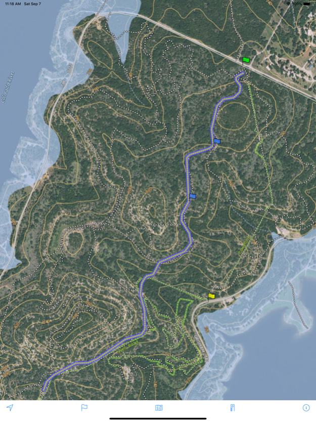
Download maps for areas of interest to view them later when you don't have Internet access or you don't want to use cell data.
TRACKING
Use location tracking to show where you are on the map, your elevation, and the accuracy of the GPS signal.
FLAGS
Flags are included with map downloads. Add flags (waypoints) to the map to mark your current location or other locations. Import flags from other sources using GPX files and geocache LOC files. Share flags with others using email or AirDrop. Organize your flag types by color, for example, geocaches, trailheads, and summits.
TRAILS
Trails are included with map downloads. Import trails (tracks) using GPX files you find on the Internet or from your personal GPS track collection. Share trails with others using email or AirDrop. Organize your trail types by color, for example, mountain bike trails, hiking trails, and OHV trails.
TRAIL RECORDING
Record your own trails to show where you've been on the map, follow them later, and share with others.
ELEVATION PROFILE
Recorded trails include an elevation profile (distance/elevation chart).
NAVIGATION
Navigate to a flag by following the direction arrow that uses your compass heading. Useful for geocaching.
MEASURE
Measure the distance between points on the map.
Note: Continued use of GPS running in the background can dramatically decrease battery life.
Sep 26, 2022
Version 6.4
- Improved map download performance in congested areas with many trails and flags
- Additional trail type included in map downloads (equestrian)
- Fix for trail length calculation when trail compression setting is on Medium or Low
- Fix for faint checkerboard pattern behind the map detail for downloads in certain areas, eg. northern Washington state
Previous Versions
Here you can find the changelog of Topo Maps US since it was posted on our website on 2016-09-25 17:38:18.
The latest version is 6.4 and it was updated on 2024-04-22 08:56:24. See below the changes in each version.
Topo Maps US version 6.4
Updated At: 2022-09-26
Changes: Sep 26, 2022
Version 6.4
- Improved map download performance in congested areas with many trails and flags
- Additional trail type included in map downloads (equestrian)
- Fix for trail length calculation when trail compression setting is on Medium or Low
- Fix for faint checkerboard pattern behind the map detail for downloads in certain areas, eg. northern Washington state
Topo Maps US version 6.3.2
Updated At: 2022-06-04
Changes: Jun 4, 2022 Version 6.3.2
- Improved readability of toolbar buttons in flag list and trail list
Topo Maps US version 6.3.1
Updated At: 2021-05-11
Changes: May 11, 2021 Version 6.3.1
Fixed a bug that prevented trails from appearing on the map for uncommon app update scenarios.
Topo Maps US version 6.3
Updated At: 2021-03-18
Changes: Mar 18, 2021 Version 6.3
The elapsed time (hours/minutes) is displayed on the screen while recording a trail. The trail details screen shows the final elapsed time and average speed.
Topo Maps US version 6.2.3
Updated At: 2020-11-28
Changes: Nov 28, 2020 Version 6.2.3
Added new map source option: USGS imagery without topographical overlay.
Topo Maps US version 6.2.2
Updated At: 2020-10-18
Changes: Oct 18, 2020 Version 6.2.2
- Fixed issue with trail recording distance appearing farther than actual distance travelled.
- Trail recording continues in locations with a limited GPS signal.
Topo Maps US version 6.2
Updated At: 2019-10-29
Changes: Oct 29, 2019 Version 6.2
- You can import a ZIP file containing GPX files. Send ZIP files to this app with AirDrop, Email, Dropbox export, etc.
- If you are having issues importing plain GPX files in iOS 13 the new ZIP import feature provides another way.
Topo Maps US version 2.2
Updated At: 2015-10-28
Topo Maps US version 6.2.3
Updated At: 1970-01-01
Changes: 2020年11月28日 Version 6.2.3
Added new map source option: USGS imagery without topographical overlay.
Topo Maps US version 6.2
Updated At: 1970-01-01
Changes: 2019年10月29日 Version 6.2
- You can import a ZIP file containing GPX files. Send ZIP files to this app with AirDrop, Email, Dropbox export, etc.
- If you are having issues importing plain GPX files in iOS 13 the new ZIP import feature provides another way.
Disclaimer
Official App Store Link
We do not host Topo Maps US on our servers. We did not scan it for viruses, adware, spyware or other type of malware. This app is hosted by Apple and passed their terms and conditions to be listed there. We recommend caution when installing it.
The App Store link for Topo Maps US is provided to you by apps112.com without any warranties, representations or guarantees of any kind, so access it at your own risk.
If you have questions regarding this particular app contact the publisher directly. For questions about the functionalities of apps112.com contact us.